

Reading Maps: The Taste of Discovery


Maps are not merely tools for finding our way through space. They are historical documents, works of art, testimonies to how people and institutions have observed, interpreted and represented territory over the centuries. Studying them often means coming across unexpected paths: a forgotten name, a city represented in a new way, a connection that crosses geographical and disciplinary boundaries.
This is precisely at the heart of the research coordinated by Jessica Gritti, Associate Professor of History of Architecture at Politecnico di Milano, developed in collaboration with the Civica Raccolta delle Stampe “Achille Bertarelli” and supported by the Scuola nazionale del patrimonio of the Ministry of Culture within the Dicolab. Cultura al digitale programme.
At the centre of the project is the Bertarelli’s Maps section, a collection of more than 3,200 items dating from the 16th to the 20th century, which is now being studied, catalogued and enhanced through new research tools and a virtual exhibition.
But, as Jessica Gritti, Paolo Bossi, Claudia Giorgi and Lorenzo Mascheretti, the Politecnico di Milano researchers involved in the project, together with Alessia Alberti of the Civica Raccolta delle Stampe “Achille Bertarelli”, explain, the value of these maps lies not only in the information they preserve. Every map is an open door to new questions, new connections and new research perspectives. It is here that research still finds its most authentic flavour: the taste of discovery.
How did this research on the Maps section of the Bertarelli Collection begin?
Jessica Gritti
Maps are one of the collections to which Achille Bertarelli devoted attention from the very beginning of his activity as a collector. They were materials in which he had a particular interest, also because the first Italian geographical congresses began to be held in the early 20th century, and he took part in them. But above all, his interest stemmed from his vocation as a collector of prints.
Bertarelli collected prints mainly for their iconographic content. He wanted to build a collection that would represent the different activities and manifestations of human life. His collection was initially very broad and included a great variety of themes related to human experience. Maps were fully part of this cultural project.
The research we are carrying out in collaboration with the Civica Raccolta delle Stampe “Achille Bertarelli” is funded by the Scuola nazionale del patrimonio e delle attività culturali, an international institute for training, research and advanced studies within the remit of the Ministry of Culture, and is devoted exclusively to the Maps section.
Over these months, we have gathered a great deal of material showing how this collection was one of those to which Bertarelli devoted the greatest attention from the outset and one of the first to be donated to the Municipality of Milan. As early as the first decades of the 20th century, exhibitions dedicated to these maps were organised, encouraging further donations from citizens and collectors.
The Bertarelli Collection opened in 1927 and will celebrate its centenary next year. Through a system of progressive donations, Bertarelli established the founding nucleus of the collection, to which many other materials were added over time. The current collection therefore includes not only the maps originally donated by Bertarelli, but also those that entered subsequently through new acquisitions and donations.
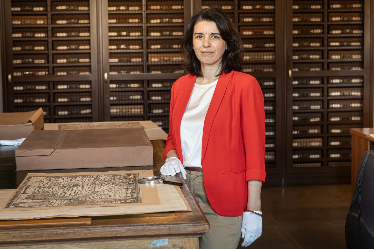
What makes maps such distinctive objects?
Claudia Giorgi
Maps represent different geographical areas and reveal much more than one might imagine at first glance. The oldest map we have studied depicts Lombardy and is particularly important because it is the oldest dated printed representation of the region after 1515 (at this link the record of the work).
It has a title in a cartouche and bears the name of the printer, Lucantonio degli Uberti, who worked in Venice near the Rialto Bridge.
The printer represents only the final stage of a highly complex production chain. First there is the cartographer who draws the territory, then the engraver who transfers that drawing onto the printing plate, and finally the printer who physically produces the work.
A 16th-century map cannot be classified according to the modern categories of physical or political maps. It represents both the geographical and human territory at the same time. Alongside natural features, there are cities, settlements, infrastructure and often references to significant historical events. This is interesting because it reminds us of a conception that we tend to have forgotten today: history and geography were considered two sides of the same coin. Knowledge of the territory was inseparable from knowledge of its history.
And it is precisely when looking at a map together with researchers that one realises how completely a detail can change the interpretation of the work. What at first glance appears to be a simple representation of the territory instead reveals a network of authors, techniques, choices and intentions.
Jessica Gritti
What Claudia Giorgi has just described is a concrete example of what happens in our research.
From a methodological point of view, the Maps section is particularly interesting because it requires much more in-depth treatment than other collections preserved in archives and cultural institutions. A map brings together different skills and professional roles. There is almost never a single author. Behind a map we find those who survey the territory, those who study it, those who represent it graphically, those who create the engraving and, finally, those who print it. In some cases, engineers and architects are also involved.
For this reason, one of the fundamental questions we always ask ourselves is: why was this map produced? What was its purpose? Who commissioned it?
The purpose for which a map is produced profoundly influences what is represented and how it is represented. Understanding the context in which it was produced is therefore essential.
One of the central aspects of the project concerns cataloguing. Why?
Jessica Gritti
Cataloguing is one of the project’s activities, but it is not the project itself. The Bertarelli already has established tools for cataloguing its materials. Our aim is to reflect on the method used to catalogue maps.
These objects require a much greater quantity of information and data than other types of prints. At present, there is no national codification that allows all the specific characteristics of maps to be adequately recorded.
As a result, different cultural institutions adopt different systems.
Most institutions choose to catalogue maps within the National Library Service, treating them as monographs. This approach, however, has some limitations.
A print is a serial product, but each individual copy has its own history. Over the centuries, it may have acquired handwritten annotations, collection stamps, signs of use and conservation interventions. All these elements, which make each copy unique, have little space in the descriptive record of the National Library Service, where the title, author and essential data of the cartographic work are recorded, sometimes entered only once for several institutions.
For this reason, the Bertarelli has chosen to catalogue maps as works of art, using the record specifically dedicated to prints developed by the Central Institute for Cataloguing and Documentation. This solution, however, also presents some critical issues, because certain data that are fundamental to cartography still have no place in the available fields.
What practical problems arise from this situation?
Jessica Gritti
The main problem concerns the ability to find information. Let me give you a concrete example. At the beginning of the project, we identified a series of drawings and maps produced by Gaspare Beretta, a Milanese military engineer who worked in various territories.
His maps were present in the Bertarelli sections, but not all of them appeared in catalogue searches because his name had not been entered in the prevailing modern (“standardised”) form and therefore appeared in different forms and in different fields. As a result, anyone searching for “Gaspare Beretta” would obtain only partial results compared with the actual number of maps attributable to his work.
This is an enormous problem for a collection containing more than three thousand maps. The same applies to proper names, places and toponyms. How should they be recorded? According to the historical form appearing on the map or according to a modern standardisation? These are seemingly technical issues, but they are fundamental to the scholarly use of the heritage. A scholar must be able to find a map. If the data are not organised in a consistent and searchable way, that map risks remaining invisible.
It is one of those moments when one understands that cataloguing is not purely archival work, but a tool capable of generating new knowledge. A name entered in the wrong field or information that cannot be searched can make an entire history of people, places and relationships invisible.
Has the research led to any unexpected discoveries?
Jessica Gritti
I like to say that my academic journey goes “from the capital to the world”. I started out as a historian of architecture working on architectural details, and in recent years I have increasingly moved towards the history of cities and territories. I had already worked on several 15th-century cities, on Milan and on territories of the Venetian Republic, particularly Bergamo. Maps have given me the opportunity to broaden my perspective even further, moving from the urban to the territorial scale.
As often happens in research, the collection proved to be much richer than we had imagined. Each of us found elements that were useful for other lines of research as well, and discovered unexpected aspects that opened up new research perspectives.
Can you give us a pratical example?
Jessica Gritti
One of the most interesting examples concerns a discovery we made together with Professor Paolo Bossi.
In the Maps section and the Plans and Views section, connections emerged with a group of Lombard engineers who, in the 17th century, later worked in Catalonia in the service of the Spanish Crown. Thanks to research conducted on the collection, we identified the presence of these figures in Lombardy before their move to Spain. It is a particularly important discovery because it has attracted the attention of Catalan scholars, for whom these figures play a fundamental role in the history of territorial cartography.
Starting from a collection preserved at Milan’s Castello Sforzesco, we realised that these materials have international relevance. It was an important surprise, which is now leading us to envisage new collaborations and new enhancement activities together with Catalan scholars.
Professor Bossi, what was the contribution of this discovery?
Paolo Bossi
My background is as an architect before being a historian of architecture; therefore, my perspective on maps is inevitably different.
When I look at a map, for example, I immediately focus on toponyms, different infrastructure systems, road networks, mountain passes and rivers. These are all elements that tell us how one territory was connected to other territories and what relationships it established.
A map is always a selection of information. It never reproduces the whole of reality, but represents what its author considers important to communicate.
For years I have been studying the work of Ambrogio or Ambrosio Borsano, a 17th- and 18th-century military engineer trained in Gaspare Beretta’s circle, who, while still young, travelled to the Iberian Peninsula in the service of the Spanish Crown.
Over time, together with several colleagues in Barcelona, we have managed to reconstruct some stages of his career and his move to Catalonia. In particular, in 1687 Borsano produced a gigantic map of Catalonia, almost three metres by more than two metres in size and extraordinarily detailed.
It was so accurate from a military point of view that the King of Spain considered it too sensitive and decided to preserve it without making it public.
Today, Catalan scholars regard that map as the first truly detailed and recognisable representation of Catalonia. For them, it has an identity value comparable to that which one of the earliest representations of Lombardy might have for us. This discovery demonstrates how the Bertarelli collection can contribute to research that extends far beyond the local and national context.
The discoveries described so far are not the result of the perspective of a single researcher. Behind every new connection there is an ongoing dialogue between different areas of expertise, allowing the same maps to be read from different perspectives.
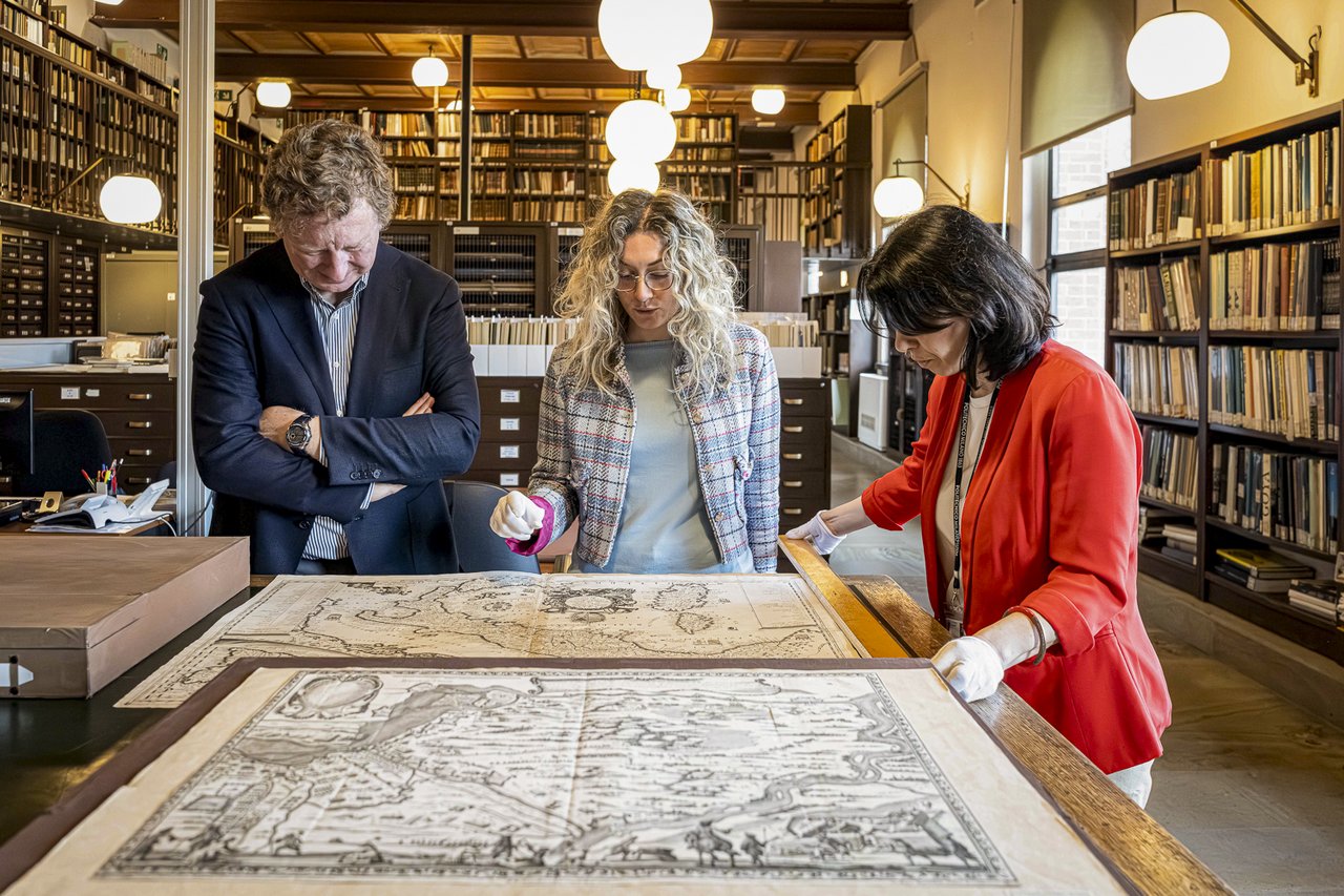
The project involves very different professional backgrounds. How important is multidisciplinarity?
Jessica Gritti
It is fundamental.
I am a historian of architecture with an initial background in Humanities. I completed my PhD at IUAV University of Venice, combining humanities and architectural history expertise.
Claudia Giorgi holds a PhD from IUAV and has a background similar to mine. Lorenzo Mascheretti, on the other hand, is a historian of modern art and brings expertise to the group that we have to a lesser extent, particularly with regard to the artistic aspects of maps.
Indeed, these objects often also involve painters and artists. We are working mainly on printed materials, but there are also painted maps that require specific art-historical expertise.
Claudia Giorgi
For me, it was particularly interesting to work on completely new material. I mainly dealt with the methodological aspects of cataloguing, and this led me to continually ask myself one question: who are we cataloguing for?
When constructing a catalogue record, we have to ask ourselves what information might be useful to future researchers and how to make it as accessible and searchable as possible. It was very stimulating work because it required us to reflect not only on the content, but also on the ways in which that content will be used in the future.
Lorenzo Mascheretti
For me, the main novelty was approaching cartography from an art-historical perspective.
I was particularly interested in the decorative features of the maps, the allegorical elements and the figures that enrich the representation of the territory.
These are aspects that often escape notice at first glance, but which sometimes involve leading artists and reveal a great deal about the cultural context in which the maps were produced.
Research, however, does not end with study and cataloguing. An important part of the project consists precisely in giving this heritage back to the community, making it accessible even to those who do not usually visit archives and libraries.
An important part of the project concerns enhancing the collection through a virtual exhibition. How did this idea come about?
Jessica Gritti
The virtual exhibition is one of the objectives set out in the project funded by the Scuola nazionale del patrimonio.
Alongside cataloguing and scholarly study, we wanted to build a tool capable of presenting the results of the research to the public and telling the story of this collection.
We are also planning a seminar open to the public, to be held on 15 October 2026, which will provide a concrete demonstration of how maps are studied and how this type of research develops. The idea is to display some pieces and explain the research process, from sources to results.
Lorenzo Mascheretti
The virtual exhibition draws on material that has already been digitised and is hosted in a new section of the institution’s website.
We chose to tell the story of the origins of the cartographic collection through the figure of Achille Bertarelli and his interests in travel, tourism and geography.
We will retrace some key moments in the history of the collection, from the geographical congresses of the early 20th century to the major exhibitions organised in Milan.
The final section of the exhibition is devoted specifically to this project and to the results achieved during these months of work.
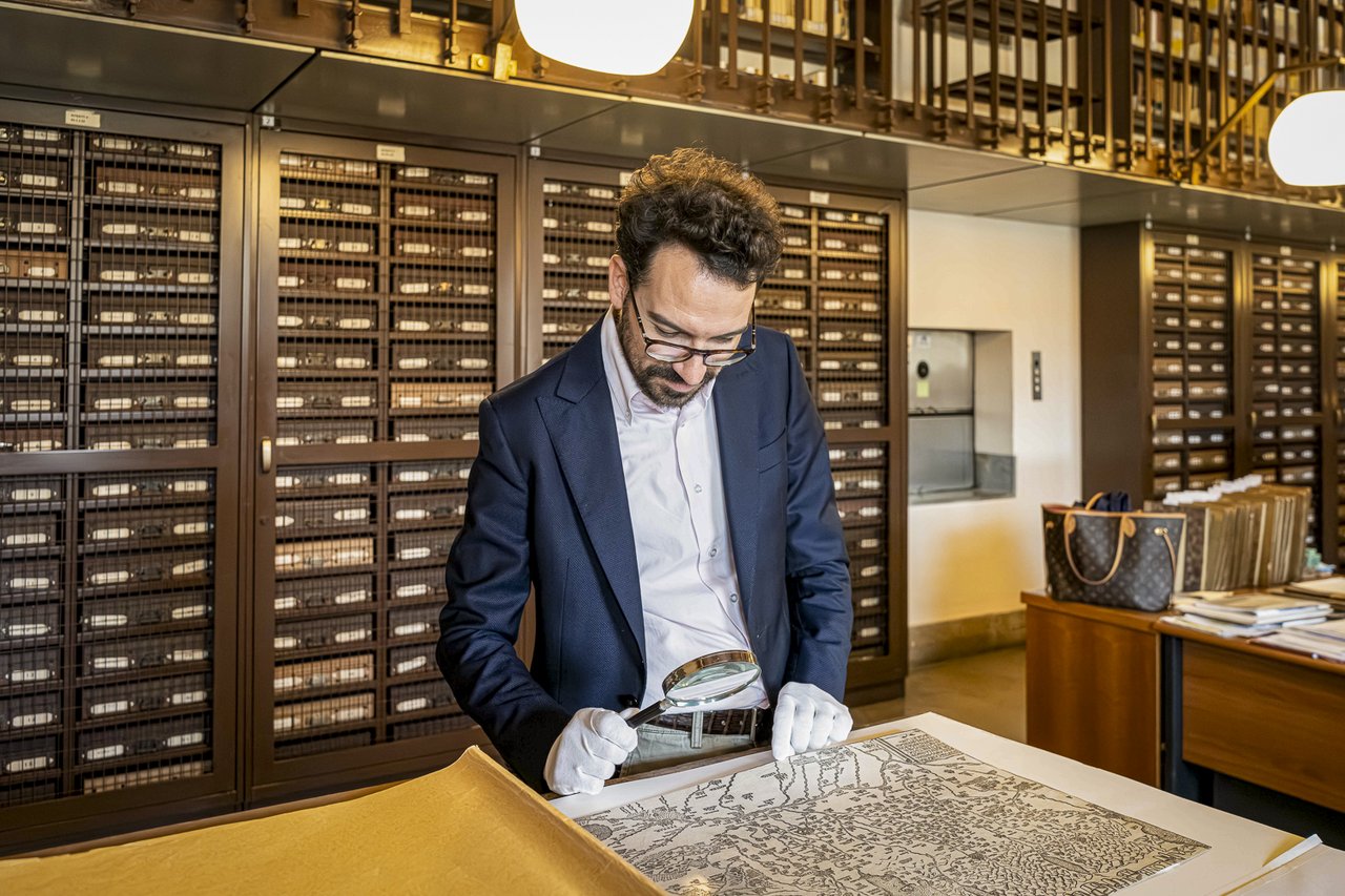
Can a virtual exhibition replace the direct experience of the works?
Jessica Gritti
Absolutely not.
Digital images offer extraordinary opportunities. They allow for highly detailed enlargements, make it possible to relate different materials to one another and provide access to content that would otherwise be difficult to consult.
However, digital technology cannot replace direct experience of the work.
These objects have material characteristics that can only be appreciated by observing them in person: the paper, the dimensions, the traces left by use, the marks of the collections that have preserved them.
For researchers, direct contact with the material remains indispensable.
The virtual exhibition is therefore not intended as an alternative to physical access, but as a complementary tool. It can engage new audiences, create opportunities for further exploration and provide permanent content for the scientific community and the public.
After months spent among maps, catalogues and international exchanges, it is natural to wonder what the most important legacy of this experience might be, not only from a scientific point of view but also on a human level.
What do you hope will remain from this experience?
Alessia Alberti
I have worked at the Bertarelli for many years, and this experience has made me understand even more clearly the importance that the Maps section had in the very foundation of the institution.
We had never had such an ongoing collaboration with a university before. Having the researchers here, present on a daily basis, exchanging ideas with them and seeing new research perspectives emerge has been extremely stimulating.
Moreover, the project has opened up an international dimension that perfectly reflects the Bertarelli’s original vocation.
Jessica Gritti
I believe this project represents not an endpoint, but a starting point. I hope it can be an important step in the collaboration between Politecnico di Milano, the Civica Raccolta Bertarelli and, more generally, the city’s cultural institutions.
I am deeply convinced that the relationship between universities and cultural institutions is fundamental: researchers can offer expertise and new research perspectives, but without cultural institutions our work would not be possible, because they are the ones that preserve the archives, documents and works that constitute the very substance of research.
It is a relationship that must necessarily be reciprocal and ongoing. University expertise must be placed at the service of society, and cultural institutions are indispensable partners in building this dialogue.
If this experience succeeds in generating new research, new collaborations and greater awareness of the value of our cultural heritage, it will have fully achieved its objective.
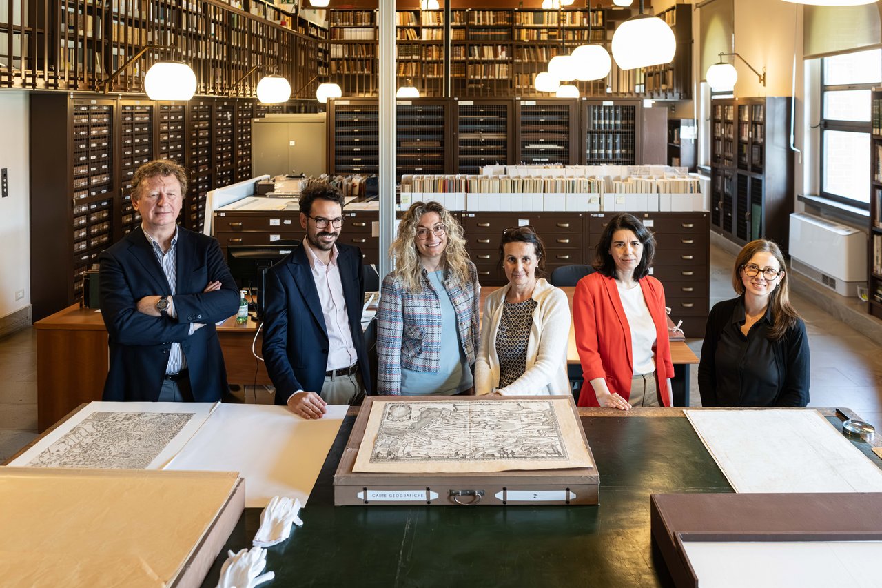
We warmly thank Professor Jessica Gritti, her research group and the Civica Raccolta delle Stampe “Achille Bertarelli” for their availability and the passion with which they accompanied us on this journey. Entering the Maps section meant learning to look at a map with different eyes: behind a cartouche, a toponym, an engraving or an apparently marginal mark lie stories, relationships and avenues of research that we could never have imagined. Perhaps this is the most valuable lesson we take away with us: research teaches us that the most surprising discoveries often arise from attention to detail.
Related stories
The creative force of mathematics, in the words of Sachiko Nakajima
The scientist and pianist is a tireless promoter of topics such as STEM, diversity and inclusion. In this interview she told us about her artistic world and her vision of mathematics.

AI to Touch: when art invites touch
Financial mathematics, AI, ESG and personal finance – QFinLab’s activities
Focus on financial education with master’s degrees, projects with schools, and targeted informational initiatives.
The eclipse that marked the end of the fourth Egyptian dynasty
Giulio Magli reveals the secrets of archaeoastronomy.

ReverseLab, a space for contemporary art between the prison and the city
Andrea Di Franco e Francesca Piredda talk about Off Campus San Vittore
You might also like

From circuit to laboratory
The collaboration with the Politecnico as seen by Autodromo Nazionale Monza

Research Takes to the Track at Monza
The agreement between Politecnico di Milano and the Monza National Circuit creates an open-air laboratory for safety, sustainability, materials, mobility and major events.

Digital sovereignty: why regulating AI is not enough
Interview with Roberto Baldoni, Senior Advisor for Technology and Cybersecurity Policy to the Ambassador of Italy to the United States