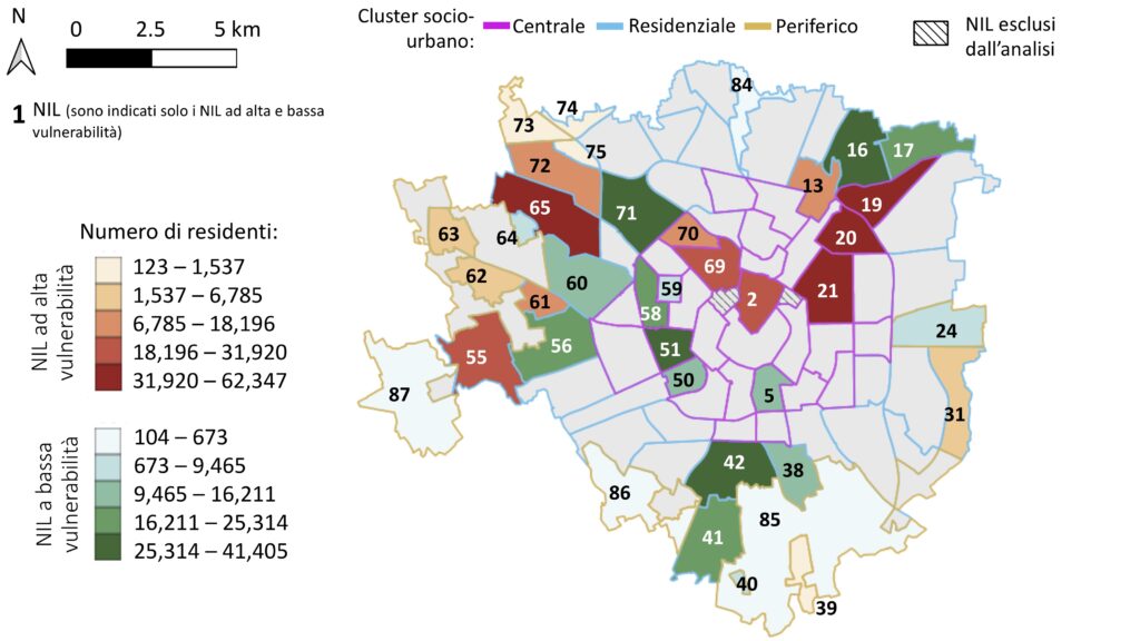
What happens when extreme heat puts people’s health at risk? And how can we use data to prevent health emergencies? These questions are answered by a study conducted by the D-Hygea Lab at the Politecnico di Milano, which analysed the impact of heat waves on the risk of cardiovascular emergencies in city districts. The result is a precise map of the most vulnerable areas, developed through the use of artificial intelligence and the analysis of over 64,000 medical interventions recorded between 2017 and 2022. The study identified 18 highly vulnerable neighbourhoods, where the risk increased by 22% during extreme heat, compared to no risk at all in the 20 most resilient neighbourhoods.
Factors contributing to vulnerability include not only the absence of green spaces and public fountains, but also demographic variables such as the advanced age of the resident population. On the contrary, more natural areas help to mitigate the negative effects of heat, highlighting the importance of conscientious urban planning.
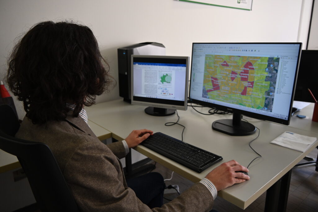
One of the authors of this research is Lorenzo Gianquintieri, a researcher who has turned his passion for bioengineering and data analysis into concrete tools for improving public health. In this interview, Lorenzo tells us how his work is opening new perspectives in preventing and managing health emergencies, not only in Milan, but potentially worldwide.
How did this line of research on the relationship between cardiovascular risk and heat waves come about?
‘The first step was methodological, dating back to my Master’s thesis, for which I applied geomatics — that is, the analysis of spatial and georeferenced data — to a public health problem. We worked on positioning external defibrillators in the best places across Milan in collaboration with the Agenzia Regionale Emergenza Urgenza, the ambulance service manager for the Lombardy Region, whom we still work with closely today.
Then, during my PhD (started in 2018), under an interdepartmental research grant with the Department of Civil and Environmental Engineering, we analysed data relating to out-of-hospital medical emergency interventions. During the 2020–2021 lockdowns, we developed short-term predictive models to support the Lombardy Region with weekly bulletins. This study led us to investigate the link between pollution and the spread of COVID-19. Using a different methodological approach, we discovered a correlation with ammonia, an under-examined pollutant, rather than with particulate matter, overturning what were then widespread assumptions.
These insights highlighted the importance of geospatial analysis, treating the entire territory as a single organism and broadening the perspective from individual physiology to an ecological and systemic view. With this approach, we recruited PhD students and developed the work on heat waves.’
What are the main results of your research on heat waves and the implications for public health?
‘The key element is the methodology. We do not stop with individual healthy or sick citizens, but rather analyse the health status of an entire population as a continuous spectrum. We adopt a “One Health” approach, also considering the environment and animal population as part of a single ecosystem.
This allows us to provide decision-makers with evidence-based guidance to optimise interventions in terms of both effectiveness and cost, but also and especially with respect to prevention. For example, we identified the percentage of natural land as the most decisive factor in mitigating the effects of heat and pollution. However, urban planning requires a balance between housing density, which favours citizen services, and the presence of green areas.’
Did you notice any counterintuitive correlations in your research, for example, between education level and cardiovascular risk?
‘Yes. We observed that neighbourhoods with a higher proportion of university graduates are more vulnerable during heat waves. One possible explanation is that they live closer to urban centres, where the effects of heat are greater. In addition, access to emergency services may be more frequent in this population, reflecting greater medical awareness. This shows that it is also crucial to correctly interpret the results.’
What role does artificial intelligence play in your study?
‘Artificial intelligence is an essential tool for analysing large amounts of data. However, the main problem in our area remains the availability and quality of the data itself. Applying complex algorithms to loosely collected data is of little use. Investments in data collection are crucial, but often underestimated compared to flashier technological developments.’
Can this research be replicated in other contexts?
‘Absolutely, yes. We have just developed a replicable model that can be adapted to different combinations of environmental factors and illnesses. For example, we can apply the same approach to study the relationship between particulate matter and respiratory diseases, or between noise pollution and mental health, provided the data are available. One of our main goals is for this model to become a new standard in this area.’
How do you view the future of this line of research?
‘My goal is to spread a new paradigm, especially within the field of bioengineering, that is, geographical analysis aimed at prevention is as important as clinical practice and it is an investment, not a cost. I hope to contribute to this change in perspective, looking at health as a continuous spectrum and not as a dichotomy between health and sickness. I am also fortunate that I can teach and pass on these ideas to younger generations, who show a growing interest in the relationship between environment and health.’
What advice would you give to someone who wants to pursue a career as a researcher?
‘I recommend believing in the research from the beginning, despite the many uncertainties. I developed this awareness along the way, but more conviction at the beginning would have allowed my actions to be more focused. Passion is also essential. Without it, the sacrifices required for research become unsustainable.’