In the context of the growing need to make cities smarter and more inclusive, researcher Daniele Treccani of the UNESCO Research Lab of Politecnico di Milano’s Mantova Campus has devoted himself to innovative research on the use of Artificial Intelligence (AI) to improve physical urban accessibility. The goal? Identifying the specific challenges posed by the characteristic streets and pavements of historic cities, especially for the elderly and mobility-impaired persons.
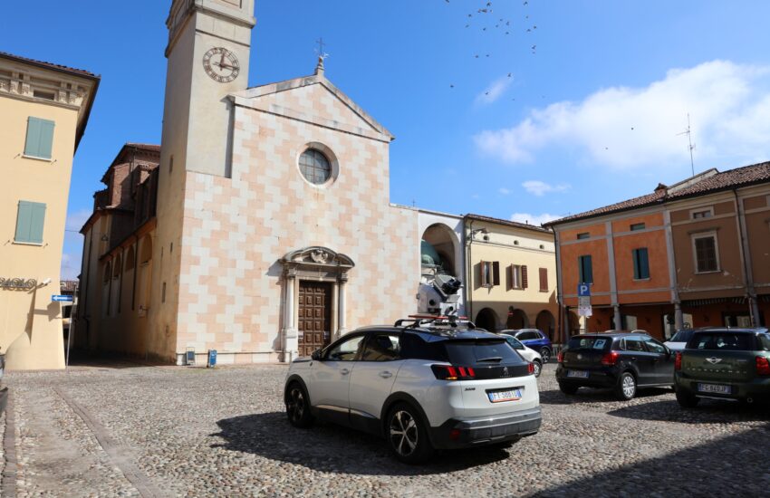
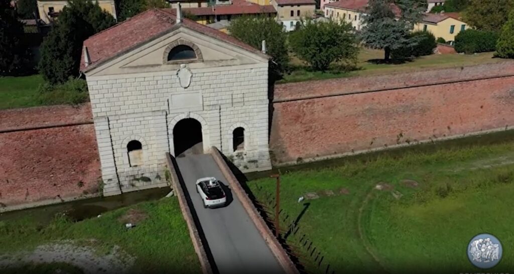
Treccani conducted a detailed study using a sophisticated mobile mapping system installed in a moving car. He focused was on Sabbioneta, a picturesque town that is a UNESCO World Heritage site since 2008 along with Mantova, famous for its Renaissance character and its historic walls.
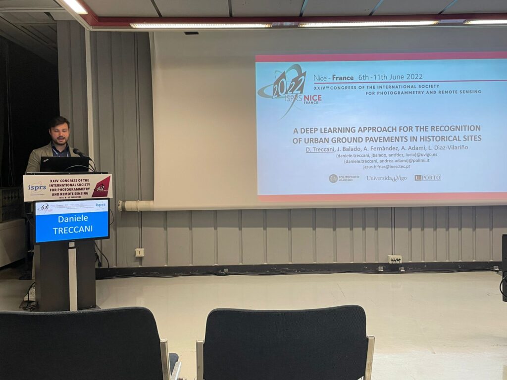
Cobbled streets, cobblestone pavements and the varying heights and widths of streets that characterise historic cities often become insurmountable obstacles for mobility-impaired persons Treccani’s research, published in theInternational Journal of Applied Earth Observation and Geoinformationexamined these features in detail, highlighting the negative impact they can have on the mobility of the elderly and people with disabilities.
Through the use of Artificial Intelligence, Treccani was able to identify and analyse the differences between different pavement types and their implications on urban accessibility. This innovative approach not only provides valuable information to improve the infrastructure, but also lays the foundation for a more inclusive and citizen-friendly urban design.
Treccani tells us how his research came about and the path that led him here.
“I graduated in Environmental Engineering from the University of Brescia”, he says. “After that, I had a Master of Science programme and wrote my thesis in collaboration with some professors from the Mantova Campus of Politecnico di Milano, including professor Andrea Adami as the discussant. I then continued with a PhD programme at Politecnico di Milano’s Department of Architecture, Built Environment and Construction Engineering with a thesis is essentially the one described in the article in the International Journal of Applied Earth Observation and Geoinformation: the work is the same, with a few minor improvements.
I participated in and won a call for junior researchers for theUNESCO Research Lab at the Mantova Campus: I am very happy of the path I have taken”.
What fascinates you about topography and cartography?
“Before university I got a land surveyor diploma: it all started with the topography course in the third year of high school. The professor passed on to me a great passion for the subject, in addition to the fact that I enjoyed the alternation of theory and practice. This interest continued at university: I had realised that I really liked the ways of narrating the territory thanks to these technological instruments.
In Geomatics, technology is very important and has made great strides over the years. We have moved from optical instruments, where the operator still had to read the aim, go and mark the number, etc., to instruments that although being based on optics, are faster and get more accurate results. Artificial Intelligence and the computational capabilities of new computers are making it possible to collect and analyse so much data in a quick and efficient manner.
The fact remains that measurement is at the basis of everything: when I want to create a digital replica, I always have to take precise and accurate measurements of the existing object, to understand what it looks like, using tools and techniques such as laser scanning and photogrammetry, and get to three-dimensional replicas that then serve as a starting point for informed decisions and data analysis”.
The new element in your research is Machine Learning and Artificial Intelligence applied to cartography… how did this integration come about?
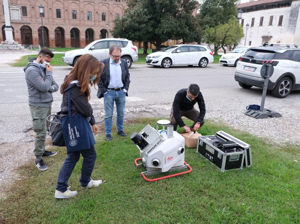
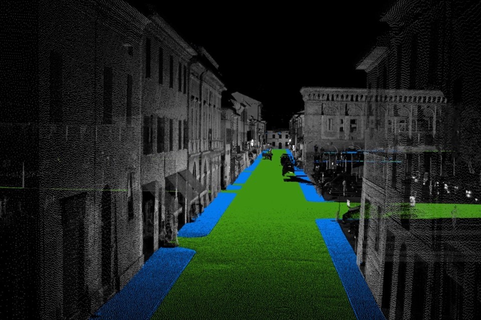
“The basis is always measurement: in my work I used mobile mapping, a set of sensors placed on a car that goes around the city and measures the surrounding space. One of these instrument is a laser scanner that takes many measurements of the space around it, returning a point cloud, i.e., a digital replica of what we have measured where surfaces are described by many points and each point corresponds to a measurement. In the case of Sabbioneta measured points are more than a billion and we know their XYZ coordinates, colour and other information.
Artificial Intelligence, and specifically Machine Learning, allows us to segment the point cloud into classes determined by us. Artificial Intelligence automatically tries to subdivide the point cloud according to the content we are interested in, e.g., by dividing it into points representing buildings, points representing pavements, points representing streets, and so on. I decided to go and develop this Machine Learning model to automatically identify the points in the point cloud belonging to pavements and those belonging to streets.
Then I analysed the pavement points and tried to extract information from them. The peculiarity of my work compared to that which they have already done in the research world is that these technologies are generally applied in very standardised contexts. Think of the streets of Milan: the pavement is raised above the road, it has a smooth surface, there is a kerb. In historical centres, however, this is not always the case: the pavement and the street are often at the same level. I took advantage of the fact that thestreet paving material is often different from that of the pedestrian pavement: in many town centres sanpietrino is used for the street and brick for the pavement, and it is based on this difference that the user can recognise the different purposes of the two surfaces, which, however, in the measured points appears to be a single surface. By using the geometric characteristics of the measured points and training this mathematical model to recognise them, I was able to identify the position of the pavements and the position of the streets, through the corresponding points.
I then focuses on extracting other information about the pavements, such as pavement material, width or slope.
Speaking with my colleague Sebastiano Marconcini (who had his PhD at Politecnico di Milano with a thesis on the concept of city for all in cultural heritage), it emerged that when a person with a disability has to visit a place he or she does not know, first he or she needs to understand whether he or she can get there and whether, once arrived, he or she can move around the city or the historic centre without difficulty.
A disabled person needs to know not only the height or accessibility of the pavement, but also how wide it is or the material it is made of – trivially, when the surface is not smooth, it becomes difficult to move on it using a wheelchair: these two pieces of information alone can help decide which is the best route for a disabled person.
This information can also be clearly for those who draw up urban plans, as in the case of Sabbioneta, or when planning accessible routes for tourists.
Sabbioneta was the ideal case, because it is a historical city with so many peculiarities: it has a chessboard pattern, it has decentralised streets, with different widths and so many different materials (sanpietrino, brick, cobblestone, porphyry…) and it is small (so we were also able to take measurements and make calculations very quickly).
This work also gave rise to the idea of a Project of Significant National Interest (‘PRIN’) extending to a portion of the city of Mantova, which is larger and more complex than Sabbioneta, with the University of Brescia and the University of Modena and Reggio Emilia. The aim is to find out whether there are other useful data to be identified and make it available to users and local authorities”.
In the future, do you think there will be other applications of the same method in other contexts?
“Classification, the point cloud, hence segmentation, works well and will always work better: in the future we may be able to identify and define other useful information. For example, still speaking of accessibility, it would be very useful to make a three-dimensional survey of a bathroom and to know in a very short time, automatically, through specially developed algorithms, whether it is accessible or not; it could be done quickly and with no need for specialised personnel. We have noticed that the height of the switches is sometimes out of reach of a wheelchair user: maybe, Artificial Intelligence will help, through automatic surveys, to figure it out on the fly without going through an in-depth measurement.
This technology can be applied not only to accessibility but also to other issue, for example fire auditing.
How do you see yourself in the coming years? Would you like to continue on this path or are you thinking of other areas of research?
“I will continue to work on point clouds, but not with Artificial Intelligence: it is a very useful tool but is not the only one to be considered and developed”.