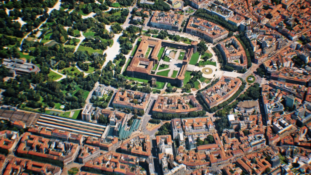
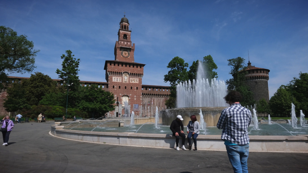
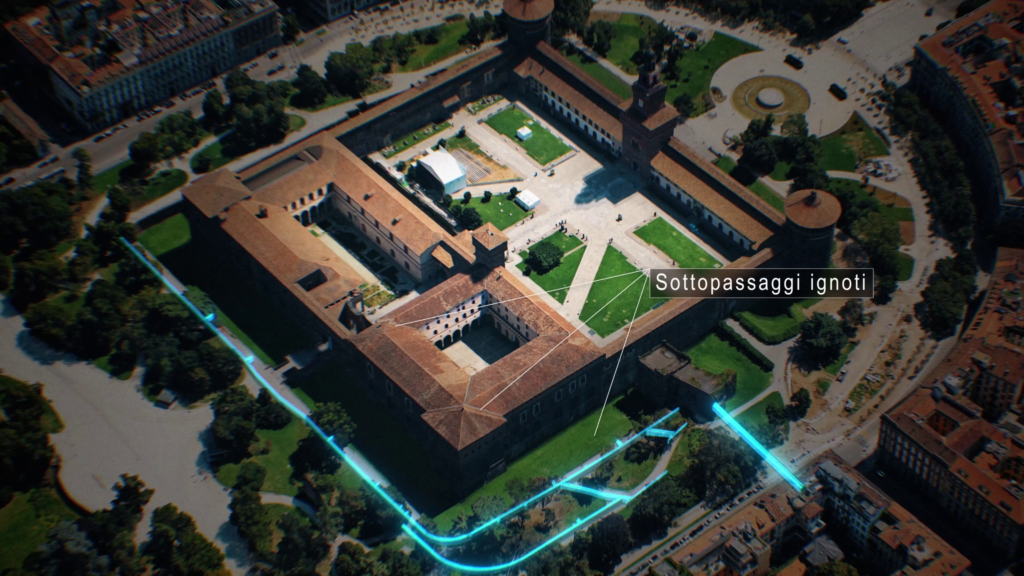
What lies beneath Milan’s Sforzesco Castle? Forgotten structures, hidden passages and traces of a past yet to be deciphered. With geomatics and state-of-the-art digital surveying technology, it is now possible to explore these spaces without invasive excavations, bringing to light valuable information on the architectural history.
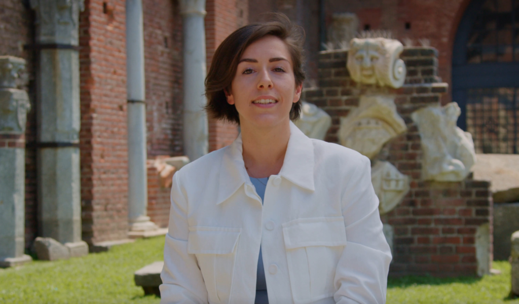
Francesca Biolo, , an architect and researcher at the Politecnico di Milano, is dedicated to this interweaving of innovation and the cultural heritage. Using advanced digitisation methods, she has studied the castle and the ground underneath, confirming the presence of structures described in drawings by Leonardo da Vinci. Her investigation not only enriches our knowledge of the past, but also opens new perspectives for protecting and enhancing our historical heritage.
In this interview, Biolo talks about her journey, research challenges and the potential of technology in rewriting the history beneath our feet.
Can you tell us about your academic and professional background? What led you to specialise in geomatics and digital surveying?
“My academic career began at the Politecnico di Milano, where I earned a Laurea (equivalent to Bachelor of Science) in Architectural Design at the Mantua campus (2014–2017) and then a Master’s degree in Building Architecture at the Milan campus (2017–2019). During my studies, I realised that design wasn’t for me, but I didn’t immediately understand the alternatives within the world of architecture. There are a lot, in reality, but I only realised this as I was finishing my studies, that is, during my PhD. In fact, I had finished my Laurea (equivalent to Bachelor of Science) and didn’t know what to do or whom to ask for a job, precisely because I was struggling for clarity about other options. The pandemic made it even more difficult to enter the sector, and that’s when I received a recommendation from my former professor, Maria Cristina Giambruno: another professor, Franco Guzzetti, was looking for a PhD student
I didn’t have a solid background in geomatics or digital surveying, but I viewed the opportunity as an exciting challenge to expand my skills. I was initially apprehensive, but I took part in the call and in hindsight, I can say that it was one of the best choices I could have made. The PhD allowed me to discover a fascinating field and explore the many applications of geomatics, both in research and in professional practice”
What exactly was your PhD research on? What technologies did you use to investigate the ground under Sforzesco Castle and what challenges did you face?
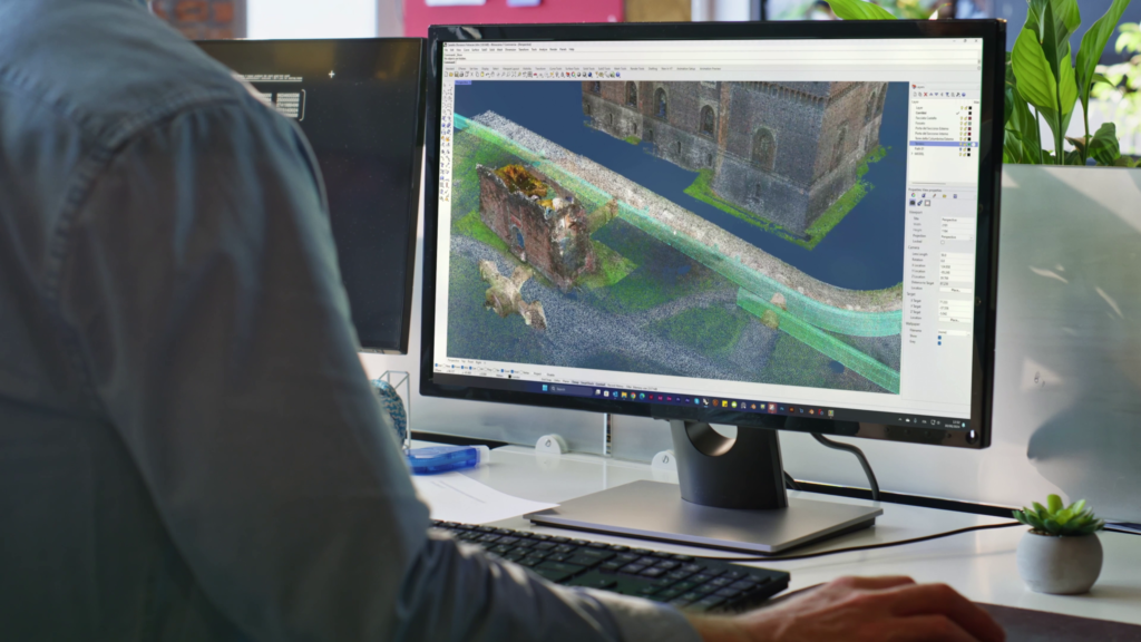
“My research focused on digitising historical buildings and organising data to improve knowledge and conservation. My goal was to develop a method to organise various types of information, such as three-dimensional surveys, historical documents and iconographic data, and integrate them in a single digital model. The system I developed is based on geometric information layers, which allow information to be classified and modelled according to its origin and degree of reliability.
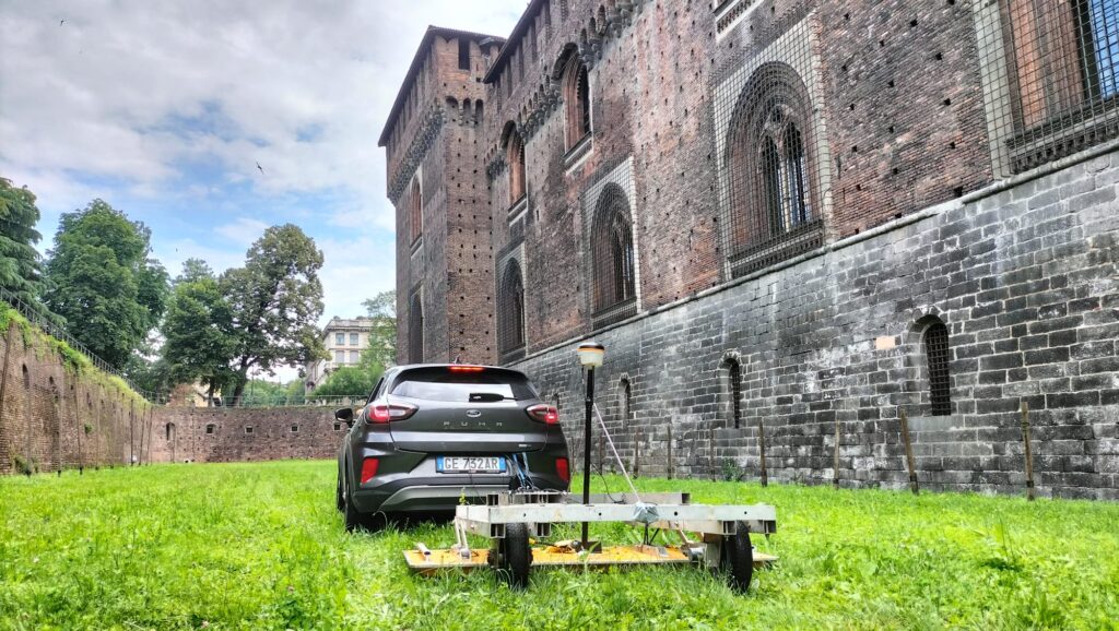
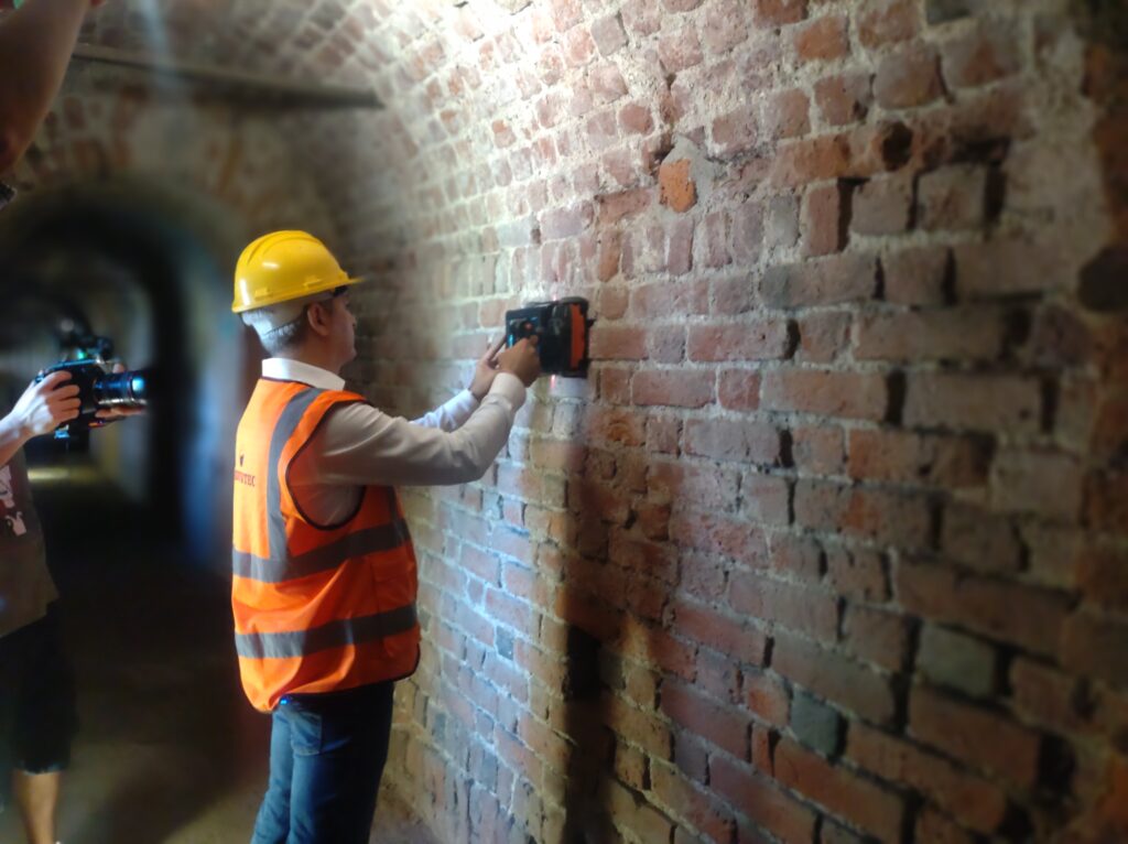
To test this method, I studied the Sforzesco Castle in Milan, combining laser scanner surveys, photogrammetry and topography with archival research. In collaboration with Codevintec Italiana s.r.l., we carried out 3D georadar surveys to investigate the underlying ground. The main difficulty related to interpreting the data. The architectural layers accumulated over the centuries mean that reading the information is complex, and solid conclusions can only be drawn using an interdisciplinary approach”
The surveys confirmed the presence of underground structures described in Leonardo da Vinci’s drawings. What is the value of these discoveries from a historical and scientific point of view?
“The discovery holds a lot of historical value because it confirms Leonardo da Vinci’s influence in the design of Sforzesco Castle and enriches its stratigraphic interpretation. Our data show that many traces of the past are still present underground, despite the demolitions that have occurred over the centuries, especially during the Napoleonic era and Luca Beltrami’s 19th-century restorations.
The value of this research goes beyond historical confirmation, however. It once again proves that by combining our expertise with historical knowledge and today’s technological possibilities, we can manage and study the built fabric and its most hidden layers non-invasively. The goal of the research is to provide concrete answers to today’s needs, both in our cities and for the architectural heritage in particular.
With this in mind, one of the most interesting developments I have been working on is the use of the collected information for three-dimensional constraint maps. These tools could govern urban planning and construction in the city near sensitive areas such as the Castle by considering the ground underneath in addition to the visible surface”
Besides academic research, how could these data be used to enhance the Sforzesco Castle and make such hidden spaces more accessible to the public?
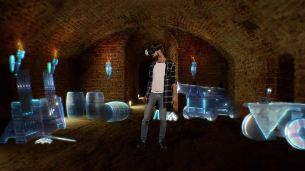
“Part of the ground under the castle is already open to visitors, but many areas remain inaccessible. The three-dimensional models generated from the surveys could be used to create immersive virtual or augmented reality experiences, allowing visitors to explore the hidden spaces digitally. This approach would offer an effective and non-invasive alternative to enhancing the site, making complex information accessible in an immediate and engaging way“.
The technologies you employed are also used in various fields, from archaeology to security. What do you think are the most interesting developments and future applications of geomatics?
“Geomatics can be applied to a vast range of topics, from knowledge about the architectural heritage to optimising energy consumption across a region, from infrastructure monitoring to urban management. Each historical period certainly makes its own advances relating to the demands of the era. For us, I think a fundamental topic is sustainability and the environment, in which a lot of work is being done. Procedures and systems to control soil consumption, methods of support and post-disaster analysis are just a few examples.”
Doing research in Italy can be complex. What do you see as the main difficulties and opportunities for those who choose this path?
“There are two critical issues: pay that is often not adjusted to the cost of living — especially in cities like Milan — and unstable contracts. However, doing research also offers unique opportunities: the chance to explore innovative topics, working in a stimulating environment and making a concrete contribution to the knowledge and conservation of our cultural heritage. Our advantage in Italy is the extraordinary wealth of history and architecture, which offers an inexhaustible field of study for those working in the field”
Looking back on your own experience, what would you recommend to someone who wants to start on a research path in your field? Are there any key skills that should be developed?
“I recommend exploring with an open mind. Geomatics and digital surveying are not yet part of the common imagination when it comes to architects’ work, but they offer extraordinary opportunities. Don’t be discouraged by a lack of initial experience. With curiosity and a willingness to learn, anyone can enter this sector even, from paths that are not strictly technical.”
What are your future research projects?
“I am currently focusing on geographic information systems (GIS) applied to both management of the built heritage and urban planning. Today, information is increasingly at the centre of our work and our lives, and this approach means we can relate entire datasets to geographical data — to coordinates, basically — thus developing tools to help manage the relatively complex systems found in our cities and territory. The future of research in this field is yet to be explored.”